What's Being Built in the East Bronx? Bally's Casino at Ferry Point, New Metro-North Stations at Morris Park & Co-op City & Wakefield's Long-Stalled Rezoning
Hush Street tracks what's changing in the East Bronx: Bally's casino resort at Ferry Point, new Metro-North stations at Morris Park and Co-op City, Montefiore's planned hospital pavilion, Slate's 483-unit Boston Road plan, the Wakefield Village rezoning and a steady mid-rise pipeline.
16
Projects Tracked
2
Metro-North Stations Under Construction
1,112
Affordable Homes Proposed at Wakefield Village
483
Apartments Filed at 2560 Boston Road
Oct. 2026
Updated
Watch →Casino Awaiting Building PermitsRezoning in Review Since 2017
By Hush Street Editorial
What’s Changing
→
Crews set structural steel for the Morris Park Metro-North station.Sep. 2026
→
MTA work began along Erskine Place for the Co-op City station.Aug. 2026
→
Bally's filed its 19-story casino resort with DOB.Jul. 2026
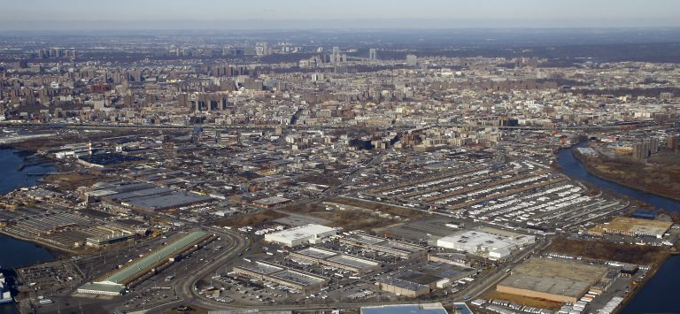
Hush Street is tracking what’s being built in the East Bronx, from Throgs Neck and Co-op City to Morris Park, Pelham Parkway, Williamsbridge and Wakefield.
The largest project is Bally’s casino resort at Ferry Point, which won one of three downstate casino licenses on Dec. 15, 2025 and filed for a 19-story complex in July 2026. Two of the four new Metro-North stations being built for Penn Station Access are here, at Morris Park and Co-op City, and the city’s 2024 station-area plan allows more housing near them.
Montefiore has filed to change its Morris Park campus plan for a new hospital pavilion, and housing proposals are larger than the area’s usual infill: Slate has filed for 483 apartments on Boston Road, and the long-pending Wakefield Village rezoning would add 1,112 affordable homes near the Wakefield station. Below that is a steady pipeline of 5- to 16-story buildings moving through DOB.
Where DOB records and press reports disagree, both are given. A permit is not treated as proof that construction has started.
Developer/ApplicantBally’s Corporation; HKS with Gensler (YIMBY)
ProjectA $4 billion casino resort with about 500 hotel rooms and a 2,000-person event center on parkland next to the Ferry Point golf course (YIMBY). The DOB filing describes a 19-story complex; CityRealty reported 256 feet, and YIMBY’s 2025 description had a 23-story hotel.
StatusLicensed; Not Yet Permitted
Latest UpdateThe state Gaming Commission licensed the casino on Dec. 15, 2025. Bally’s filed new-building and foundation applications in July 2026; the main application is in DOB objections, and only site-fence and trailer permits have been issued.
A Casino in a City Park
The city completed the map and zoning changes and the disposition of the parkland in 2025 (ZAP 2024X0237).
Erskine Place and the rail line at Co-op City, via Google Maps. —
Imagery: Google Maps
Address/LocationErskine Place, at the Amtrak Hell Gate Line
Developer/ApplicantMTA Metro-North Railroad; Halmar International and RailWorks
ProjectOne of four accessible Bronx stations being built for Penn Station Access, which will bring Metro-North trains to Penn Station (MTA). The city’s station-area plan adds a bus turnaround at Erskine Place.
StatusUnder Construction
Latest UpdateMTA work along Erskine Place is scheduled from August 2026 through January 2027. The MTA lists 2030 for full completion; THE CITY reported in May 2026 that Amtrak had suggested first service by early 2029.
A Station for Co-op City
Co-op City is a 15,372-unit Mitchell-Lama cooperative, according to its operator, Riverbay Corp. THE CITY put the full Penn Station Access project at $2.9 billion.
Developer/ApplicantWalton Developers; Leandro Nils Dickson Architect
ProjectTwo six-story buildings with 81 and 80 apartments, 161 in all, which the DOB filings describe as affordable housing, on a vacant, fenced lot (DOB).
StatusFiled (Plan Review)
Latest UpdateBoth applications, filed March 31, 2026, were in DOB objections as of September.
Rare Multifamily in Throgs Neck
The filings do not give income levels for the apartments.
Sources: NYC DOB NOW jobs X01380721-I1 and X01380723-I1 (Sept. 2026)
Morris Park, Pelham Parkway & Westchester Square
A new station, a planned hospital tower, supportive housing on the Jacobi campus and the biggest housing filing in the area.
5
Morris Park Metro-North Station
The rail line at Eastchester Road in Morris Park, via Google Maps. —
Imagery: Google Maps
Developer/ApplicantMTA Metro-North Railroad; Halmar International and RailWorks
ProjectA Penn Station Access station serving the Hutchinson Metro Center office campus and the Montefiore Einstein and Jacobi hospital campuses, with a new public plaza mapped by the city in 2024 (MTA, ZAP).
StatusUnder Construction
Latest UpdateCrews set structural steel in September 2026, with bridge work on Eastchester Road through October (MTA). The MTA lists 2030 for full completion; Amtrak has suggested first service by early 2029, THE CITY reported.
Steel at Morris Park
The 2024 Bronx Metro-North plan raised allowable housing density around the station.
ProjectA change to Montefiore’s Morris Park campus plan to create a new high-acuity intensive care hospital center (ZAP). Crain’s reported plans for a 20-story medical pavilion.
StatusFiled (Pre-Certification)
Latest UpdateThe application was still under City Planning review before certification at its last update on Aug. 19, 2026; full public land-use review would follow.
ProjectA 14-story building with 483 apartments and a supermarket (DOB, News 12). The 2022-23 rezoning approved a smaller plan: nine stories, 333 affordable apartments and a 15,000-square-foot supermarket (ZAP 2019X0240).
StatusFiled (Plan Review)
Latest UpdateSlate filed the 14-story application in January 2026, and it remains in DOB objections. News 12 reported in November 2025 that there was no confirmed construction timeline.
Bigger Than What Was Approved
News 12 described the larger plan as a revised proposal still in review; it is unclear whether it needs new land-use approvals.
Allerton & Pelham Parkway Infill, via Google Street View. —
Imagery: Google Street View
Address/Location2512 Bronx Park East, with 626 Pelham Parkway South, 3006 and 3070 Williamsbridge Road and 2322 Holland Avenue
Developer/ApplicantVarious owners (DOB)
ProjectFive mid-rise buildings of six to nine stories with about 332 apartments in all (DOB).
StatusPartly Permitted
Latest UpdateDOB issued permits in 2026 for an 83-unit building at 2512 Bronx Park East and a 55-unit building at 3006 Williamsbridge Road; the other three are in review or objections.
Steady Mid-Rise Growth
Mid-rise filings like these make up most of the area’s new housing.
Sources: NYC DOB NOW jobs X00916813-I1, X01375075-I1, X01194154-I1, X01354549-I1 and X01438134-I1 (Aug. 2026); New York YIMBY (Sept. 2026)
Williamsbridge, Wakefield & Eastchester
A rezoning nine years in review, new filings along White Plains Road and one developer’s string of 99-unit buildings.
11
Wakefield Village
The area around the Wakefield Metro-North station, via Google Maps. —
Imagery: Google Maps
ProjectA rezoning for six buildings with 1,112 affordable apartments, retail, community space and a 721-space garage on a manufacturing-zoned site near the Wakefield station (ZAP).
StatusFiled (Pre-Certification)
Latest UpdateThe application, filed in 2017, is still under City Planning review before certification; its record was last updated May 29, 2026.
Nine Years in Review
Newman Architects’ project page describes about 1,200 mixed-income affordable and workforce homes.
ProjectA 12-story mixed-use building with 220 apartments (DOB, YIMBY).
StatusFiled (Plan Review)
Latest UpdateThe application, filed in March 2026, is in DOB objections. A nine-story, 46-unit building next door at 4563 Furman Avenue has had permits since November 2024.
A Larger Building for Wakefield
The developer is also behind a senior building at 1810 Randall Avenue in Soundview.
Sources: New York YIMBY (Mar. 2026); NYC DOB NOW job X01374198 (Mar. 2026)
13
3901 White Plains Road Rezoning
3901 White Plains Road Rezoning, via Google Street View. —
Imagery: Google Street View
ProjectAn eight-story building with 136 units that DOB describes as a nonprofit institution with sleeping accommodations; the operator has not been identified.
StatusUnder Construction
Latest UpdatePermits were issued in November 2024, DOB inspectors recorded the eight-story site active in August 2025, and the job’s filings were updated in September 2026. Completion has not been confirmed.
A Nonprofit Residence
No certificate of occupancy has been found.
Sources: NYC DOB NOW job X00902721-I1 and ECB records (Sept. 2026)
15
Williamsbridge, Wakefield & Eastchester Infill
Williamsbridge, Wakefield & Eastchester Infill, via Google Street View. —
Imagery: Google Street View
Address/Location4180 Carpenter Avenue, with 3556 Holland Ave., 3743 White Plains Rd., 3374 Boston Rd., 3377 Eastchester Rd., 4230 Peters Pl. and 4241 Webster Ave.
Developer/ApplicantVarious owners (DOB)
ProjectSeven buildings of five to 13 stories with about 637 apartments in all along White Plains Road, Boston Road and nearby streets (DOB).
StatusPartly Permitted
Latest UpdateDOB issued permits for 3556 Holland Avenue in October 2025, 3743 White Plains Road in December 2025 and 3377 Eastchester Road in June 2026. New 99-unit filings at 4230 Peters Place and 4241 Webster Avenue arrived in September and October 2026.
The Mid-Rise Pipeline
Several of the filings are amendments, so unit counts may change.
Sources: NYC DOB NOW filings, Community District 12 (Oct. 2026); New York YIMBY (Dec. 2024)
16
Westorchard Management's Filings
Westorchard Management's Filings, via Google Street View. —
Imagery: Google Street View
Address/Location2112 Colonial Avenue, with 1746 and 1760 Pilgrim Ave., 3305 Country Club Rd. and 610 E. 226th St.
Developer/ApplicantWestorchard Management
ProjectFive buildings of four to 16 stories with about 439 apartments in all, most at 99 units or fewer each (DOB).
StatusFiled (Plan Review)
Latest UpdateAll five applications were in DOB review or objections in October 2026; none has a permit.
One Developer, Five Buildings
Many of the area’s new filings stop at or just under 99 apartments; this developer’s five follow that pattern.
Sources: NYC DOB NOW jobs X01416342-I1, X01377488-I1, X01377544-I1, X01345266-I1 and X01306345-I1 (Oct. 2026); New York YIMBY (Aug. 2026)
What We're Watching Next
Foundation permits for Bally’s, the opening timeline for the Morris Park and Co-op City stations, certification of Montefiore’s hospital plan, whether Slate’s larger Boston Road plan needs new approvals, and movement on the Wakefield Village rezoning are next.