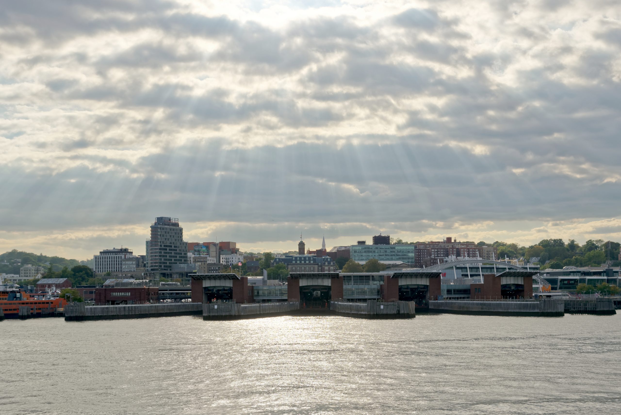
The St. George ferry terminal and waterfront seen from New York Harbor
Development Tracker — St. George & the North Shore

What's Being Built in St. George & the North Shore? 2,500 Homes Planned for the Wheel Site, Stalled Towers & a New Stapleton Waterfront

Hush Street tracks what's changing in St. George, Tompkinsville, Stapleton and Rosebank: a rezoning of the Empire Outlets and New York Wheel sites for up to 2,500 homes, stalled and approved towers above the ferry, a Family Court expansion, new esplanades and the Stapleton waterfront.
17
Projects Tracked
2,500
Homes Proposed for the Outlets & Wheel Sites (Ceiling)
5
Under Construction
2
Stalled Sites
Oct. 2026
Updated
Watch → River North Site for Sale Urby Phase 2 Stalled
What’s Changing
→
The School Construction Authority filed for a construction fence at the Curtis High School annex site.Oct. 2026
→
NYCEDC held public scoping for the Empire Outlets and Wheel site rezoning.Sep. 2026
→
The city's site selection for the Family Court expansion completed mayoral review.Aug. 2026
Under Construction5
Approved3
Planned or Proposed6
Stalled2
Completed1
See full project list →

Hush Street is tracking what’s being built in St. George, Tompkinsville, Stapleton and Rosebank, on Staten Island’s North Shore.

The pattern here traces to the Bay Street Corridor rezoning approved in 2019, which allowed more housing between St. George and Stapleton. The city’s 2023 North Shore Action Plan then committed about $400 million to a continuous waterfront esplanade, with targets of 2,400 homes and 20 acres of open space, NYCEDC says.

The biggest change under study is at the failed tourist waterfront: NYCEDC wants to rezone the Empire Outlets mall, which it says is about half vacant, and the unbuilt New York Wheel site for up to 2,500 homes, and began environmental review in August 2026. Upland in St. George, three tower plans cluster at Hamilton Avenue and Stuyvesant Place alongside a new high school annex and a Family Court expansion. In Stapleton, a developer was chosen for more than 500 mass-timber apartments, while the second phase of Urby has sat empty for a decade.

Where DOB records and press reports disagree on heights or unit counts, both are given. A permit is not treated as proof that construction has started.

Project Location Status
1Empire Outlets & the Former New York Wheel Site Richmond Terrace by the ferry terminal In Environmental Review
2St. George Esplanade & Pier 1 Richmond Terrace waterfront Under Construction
3Lighthouse Point (5 Bay Street) Bay St. at Richmond Terrace Phase 1 Open; Phase 2 Unbuilt
4River North (8 Stuyvesant Place) Stuyvesant Pl. at Richmond Terrace Stalled
537-59 Hamilton Avenue Hamilton Ave. near Stuyvesant Pl. Rezoning Approved
6198-208 Richmond Terrace Richmond Terrace near Hamilton Ave. Rezoning Approved
7Staten Island Family Court Consolidation Richmond Terrace & Hamilton Ave. Approved; Procurement
8Curtis High School Annex (25 Wall Street) Wall St. near Hamilton Ave. Early Site Work Filed
9Tompkinsville Esplanade Bay St. waterfront, Tompkinsville Under Construction
10Mary Cali Dalton Recreation Center Hannah St. by Lyons Pool Under Construction
11Hillside Grove (539 Jersey Street) Jersey St. at Victory Blvd. Developer Selected
12274 Victory Boulevard Victory Blvd., Tompkinsville Under Construction
13Bay Street & Victory Boulevard Gateway Bay St. at Victory Blvd. Concept
14New Stapleton Waterfront Front St. at Canal St. Developer Selected
15Urby Staten Island Phase 2 Hudson View Loop, Stapleton Stalled
16541 Bay Street Bay St., Stapleton Filed (Plan Review)
17P.S. 13 Annex (Rosebank) Virginia Ave., Rosebank Under Construction

The St. George Waterfront

A mall and a Ferris wheel that never turned are being replanned for housing, with a new esplanade in front.

1

Empire Outlets & the Former New York Wheel Site

Google Street View of Empire Outlets, 55 Richmond Terrace, Staten Island, NY
Empire Outlets & the Former New York Wheel Site, via Google Street View. — Imagery: Google Street View
Address/Location55 Richmond Terrace, with the Wheel site at 75 Richmond Terrace
Developer/ApplicantNYCEDC and NYC DCAS (applicants); a developer is to be chosen after rezoning
ProjectA rezoning of the Empire Outlets site and the unbuilt New York Wheel site for up to 2,500 homes, plus retail and open space (NYCEDC). Current zoning allows only the outlet and Wheel uses.
StatusIn Environmental Review
Latest UpdateNYCEDC published the draft scope of its environmental review on Aug. 26, 2026 and held a public scoping meeting on Sept. 29. Earlier coverage expected land-use review in 2026; the Staten Island Advance reported in June that it would come in 2027, with developer selection in 2028.

A Half-Empty Mall and a Wheel That Never Turned

NYCEDC’s scoping presentation says the outlet center is about 50 percent vacant. Only the Wheel’s footings were built; its 950-space garage operates, and FXCollaborative’s renderings keep the footings as features of the new waterfront.

Sources: NYCEDC scoping presentation (Sept. 2026); NYCEDC; 6sqft (Nov. 2025); Staten Island Advance (June 2026)

2

St. George Esplanade & Pier 1

Google Maps of St. George Ferry Terminal, Staten Island, NY
The St. George waterfront, via Google Maps. — Imagery: Google Maps
Developer/ApplicantNYCEDC
ProjectA new waterfront esplanade in front of the former Wheel site and a rebuilt Pier 1, part of the North Shore Action Plan (NYCEDC).
StatusUnder Construction
Latest UpdateEmergency bulkhead and shoreline repairs began in spring 2026, the Staten Island Advance reported. NYCEDC’s September presentation lists the esplanade for summer 2028 and Pier 1 for fall 2028.

A Smaller Pier

An Army Corps public notice in September 2026 shows the outer part of Pier 1 demolished and replaced with a smaller fishing pier and a gangway to a barge dock, the Staten Island Advance reported; Rep. Nicole Malliotakis said she had been told the pier would be rehabilitated. NYCEDC calls the drawings preliminary.

Sources: Staten Island Advance (May 2026); Staten Island Advance (Oct. 2026); NYCEDC scoping presentation (Sept. 2026)

3

Lighthouse Point (5 Bay Street)

Google Street View of Lighthouse Point, 5 Bay Street, Staten Island, NY
Lighthouse Point (5 Bay Street), via Google Street View. — Imagery: Google Street View
Address/Location5 Bay Street
Developer/ApplicantTriangle Equities with Lubert-Adler, on city land leased through NYCEDC
ProjectA 115-unit apartment building, 30 of them affordable, with restored historic buildings and retail (The Real Deal). The Real Deal describes 13 stories; a 2015 DOB filing listed 16.
StatusPhase 1 Open; Phase 2 Unbuilt
Latest UpdateThe residences opened in June 2025 (NYCEDC). The Real Deal reported in July 2026 that Triangle is marketing the leasehold for about $45 million. The second phase, including a long-promised hotel, has not broken ground.

First Piece Done, Second Waiting

It was the first finished project of the North Shore Action Plan.

Sources: NYCEDC (June 2025); The Real Deal (July 2026)

Towers, a Courthouse & a School Above the Ferry

Three tower plans, a Family Court expansion and a high school annex within a few blocks of Hamilton Avenue.

4

River North (8 Stuyvesant Place)

Google Street View of 8 Stuyvesant Place, Staten Island, NY
River North (8 Stuyvesant Place), via Google Street View. — Imagery: Google Street View
Address/Location8 Stuyvesant Place, with 170-208 Richmond Terrace
Developer/ApplicantMadison Realty Capital (DOB owner contact); FXCollaborative
ProjectAn approved high-rise housing site. The City Council approved a 524-unit project in 2021 (Staten Island Advance); Madison’s 2022 DOB filings add up to 799 units across three buildings; JLL’s 2026 sale listing describes 504 units.
StatusStalled
Latest UpdateNo DOB work permits have been issued. JLL is marketing the site for sale (listing updated Sept. 8, 2026), and the Staten Island Advance reported in March that the plans remain subject to a state soil-contamination review.

Approved, Then Put Up for Sale

The rezoning was approved in 2021 (ZAP 2019R0212). JLL’s listing cites about $42.3 million in brownfield tax credits.

Sources: JLL listing (Sept. 2026); Staten Island Advance (Mar. 2026); NYC Planning ZAP 2019R0212; NYC DOB NOW jobs S00661600-I1, S00661663-I1 and S00661661-I1 (July 2026)

5

37-59 Hamilton Avenue

Google Street View of 37 Hamilton Avenue, Staten Island, NY
37-59 Hamilton Avenue, via Google Street View. — Imagery: Google Street View
Address/Location37-59 Hamilton Avenue
Developer/ApplicantMega Development Group (Staten Island Advance)
ProjectAn 18-story building with 369 apartments, 111 of them affordable under mandatory inclusionary housing, and 146 parking spaces, replacing six century-old houses (ZAP, Staten Island Advance).
StatusRezoning Approved
Latest UpdateThe City Council approved the rezoning in April 2026 after a City Planning Commission vote on March 4. No DOB new-building application had been filed as of late October.

Next Door to River North

The developer told the Council it was in talks with HPD about a middle-income homeownership component, the Staten Island Advance reported; that is not in the approved plan.

Sources: NYC Planning ZAP 2023R0189; Staten Island Advance (Mar. 2026)

6

198-208 Richmond Terrace

Google Street View of 198 Richmond Terrace, Staten Island, NY
198-208 Richmond Terrace, via Google Street View. — Imagery: Google Street View
Address/Location198-208 Richmond Terrace
Developer/ApplicantZHL Group; ZArchitecture
ProjectA 14-story rental building with 117 apartments, 30 of them permanently affordable, and about 10,000 square feet of community space (ZAP, YIMBY).
StatusRezoning Approved
Latest UpdateThe City Council approved the rezoning in July 2026. No construction timeline has been announced, and no DOB filing has been made.

Four Parking Spaces

Community Board 1 recommended denial over parking; the plan includes four spaces, YIMBY and the Staten Island Advance reported.

Sources: New York YIMBY (July 2026); NYC Planning ZAP 2024R0300

7

Staten Island Family Court Consolidation

Google Street View of 100 Richmond Terrace, Staten Island, NY
Staten Island Family Court Consolidation, via Google Street View. — Imagery: Google Street View
Address/Location100 Richmond Terrace, with a new addition at 10 Hamilton Avenue
Developer/ApplicantMayor’s Office of Criminal Justice and DCAS; DASNY (design-build)
ProjectConsolidation of the borough’s Family Court facilities with a new eight-story addition at 10 Hamilton Avenue and a full renovation of the 1930s courthouse at 100 Richmond Terrace (DASNY). A state environmental notice describes a new building of about 124,000 square feet.
StatusApproved; Procurement
Latest UpdateThe city’s site selection was approved, with mayoral review completed Aug. 3, 2026 (ZAP). DASNY issued a request for design-build teams in May 2026.

A Courthouse Addition

Community support depended on a parking deal, the Staten Island Advance reported.

Sources: NYC Planning ZAP 2025R0137; DASNY (May 2026); NYSDEC Environmental Notice Bulletin (Jan. 2026)

8

Curtis High School Annex (25 Wall Street)

Google Street View of 25 Wall Street, Staten Island, NY
Curtis High School Annex (25 Wall Street), via Google Street View. — Imagery: Google Street View
Address/Location25 Wall Street
Developer/ApplicantNYC School Construction Authority
ProjectAn 801-seat high school annex for Curtis High School, which ran at 127 percent of its target enrollment in 2024-25, on a parking lot (Staten Island Advance).
StatusEarly Site Work Filed
Latest UpdateThe School Construction Authority filed for a construction fence on Oct. 13, 2026, the first DOB sign of work at the site. Borough President Vito Fossella had proposed moving a different school instead; the Department of Education rejected that, the Staten Island Advance reported in April.

Relief for a Crowded High School

It is part of the cluster of projects around Hamilton Avenue that drew complaints about uncoordinated planning and parking.

Sources: Staten Island Advance (Apr. 2026); NYC DOB NOW job S01471750-I1 (Oct. 2026)

Tompkinsville, Stapleton & Rosebank

Waterfront parks under way, affordable housing on a sanitation garage site, mass-timber apartments and a decade-old stall.

9

Tompkinsville Esplanade

Google Maps of Tompkinsville, Staten Island, NY
The Tompkinsville waterfront, via Google Maps. — Imagery: Google Maps
Developer/ApplicantNYCEDC with NYC DOT and NYC Parks
ProjectAbout two acres of new waterfront open space filling the gap between St. George and Stapleton (NYCEDC).
StatusUnder Construction
Latest UpdateConstruction began in spring 2025. NYCEDC’s September 2026 presentation lists the first phase for spring 2028.

Closing the Gap on the Waterfront

The City Council’s NorthShoreNYC plan, announced in September 2026, includes money toward its construction, the Staten Island Advance reported.

Sources: NYCEDC (May 2025); NYCEDC scoping presentation (Sept. 2026); NYC Planning ZAP 2022R0170

10

Mary Cali Dalton Recreation Center

Google Street View of 1 Hannah Street, Staten Island, NY
Mary Cali Dalton Recreation Center, via Google Street View. — Imagery: Google Street View
Address/Location1 Hannah Street
Developer/ApplicantNYC Parks with the Department of Design and Construction; ikon.5 architects
ProjectA $92 million, four-story recreation center on the site of the former Cromwell Center, demolished in 2013 (Mayor’s Office, Staten Island Advance). DOB lists 54,860 square feet; the Staten Island Advance reported 45,000.
StatusUnder Construction
Latest UpdateDOB renewed construction permits in July 2026 and issued a plumbing permit in September. NYCEDC’s September presentation lists it for fall 2026; an opening had not been confirmed as of late October.

Delayed by a Power Hookup

A Con Edison connection problem pushed back the opening, the Staten Island Advance reported in April 2026.

Sources: Staten Island Advance (Apr. 2026); NYC Mayor's Office (Feb. 2024); NYC DOB NOW job S00920468-I1 (Sept. 2026)

11

Hillside Grove (539 Jersey Street)

Google Street View of 539 Jersey Street, Staten Island, NY
Hillside Grove (539 Jersey Street), via Google Street View. — Imagery: Google Street View
Address/Location539 Jersey Street, a city sanitation garage
Developer/ApplicantVolunteers of America-Greater New York, Spatial Equity Co. and Nehemiah HDFC, designated by HPD; Purpose by Design Architects
ProjectConversion of a sanitation garage site into 232 affordable homes in three buildings, for seniors, renters and co-op buyers, with a grocery store (HPD). NYSERDA lists the first phase at 144 units.
StatusDeveloper Selected
Latest UpdateHPD designated the team in December 2024. NYSERDA lists the first phase for completion in 2029. No DOB new-building filing has been made.

Homes on a Garage Site

Sanitation operations are moving to a new garage at Fresh Kills, HPD said.

Sources: NYC HPD (Dec. 2024); NYSERDA Buildings of Excellence

12

274 Victory Boulevard

Google Street View of 274 Victory Boulevard, Staten Island, NY
274 Victory Boulevard, via Google Street View. — Imagery: Google Street View
Address/Location274 Victory Boulevard
Developer/Applicant252 Victory Affordable Housing Development Fund Co. (owner of record); Newman Design Architects
ProjectA five-story building with 75 apartments, filed with HPD involvement after a 2022 rezoning (DOB, ZAP). The affordability mix has not been published.
StatusUnder Construction
Latest UpdateDOB issued foundation, excavation and structural permits in fall 2025 and renewed construction permits in September and October 2026. Inspectors recorded active work in November 2025 and August 2026.

Staten Island's Largest Filing of the Spring

YIMBY listed it as Staten Island’s largest new-building filing of the second quarter of 2026.

Sources: New York YIMBY (Sept. 2026); NYC DOB NOW job S01016888-I1 and ECB records (Oct. 2026); NYC Planning ZAP P2018R0326

13

Bay Street & Victory Boulevard Gateway

Google Maps of Bay Street and Victory Boulevard, Staten Island, NY
Bay Street at Victory Boulevard, via Google Maps. — Imagery: Google Maps
Developer/ApplicantVertus Asset Management (assembling sites); a city DOT lot at 54 Central Avenue
ProjectA redevelopment of the Bay Street and Victory Boulevard intersection backed by the City Council’s NorthShoreNYC plan, announced Sept. 25, 2026, including the city-owned DOT lot (Staten Island Advance).
StatusConcept
Latest UpdateThe Staten Island Advance found in October that key parcels on the plan’s map are not owned by the developer; Vertus said it was working to acquire them.

A Plan Ahead of the Land

The Council plan also targets the Western Beef lot in Stapleton and the former Staten Island Hospital site.

Sources: Staten Island Advance (Oct. 2026); Staten Island Advance (Oct. 2026)

14

New Stapleton Waterfront

Google Street View of Front Street and Canal Street, Staten Island, NY
New Stapleton Waterfront, via Google Street View. — Imagery: Google Street View
Address/LocationFront Street at Canal Street, the former Navy Homeport
Developer/ApplicantArtimus and Phoenix Realty Group, selected by NYCEDC; GF55 Architects
ProjectMore than 500 mixed-income apartments in mass-timber buildings, about a quarter of them affordable, next to a six-acre waterfront park (NYCEDC). StructureCraft, the timber engineer, describes 600 units.
StatusDeveloper Selected
Latest UpdateNYCEDC chose the team in May 2025 and expects housing construction to start in 2027. The park and esplanade have been under construction since September 2024.

The City's Largest Mass-Timber Housing

NYCEDC calls it the largest mass-timber housing project in New York City.

Sources: NYCEDC (May 2025); NYCEDC project page; StructureCraft

15

Urby Staten Island Phase 2

Google Street View of Urby Staten Island, Stapleton, NY
Urby Staten Island Phase 2, via Google Street View. — Imagery: Google Street View
Address/Location5 Hudson View Loop
Developer/ApplicantIronstate Development (owner of record Homeport II LLC)
ProjectThe second phase of the Urby rental complex, about 300 units (Staten Island Advance). A 2015 DOB filing for 328 units was disapproved in 2016.
StatusStalled
Latest UpdateThe Staten Island Advance found in June 2026 that the lot sits vacant and is used for parking, a decade after the 570-unit first phase opened. NYCEDC gave no timeline, and Ironstate did not respond.

A Decade Without a Second Phase

NYCEDC described its contact with the developer as intermittent, the Staten Island Advance reported.

Sources: Staten Island Advance (June 2026); NYC DOB BIS job 520138734 (accessed Oct. 2026)

16

541 Bay Street

Google Street View of 541 Bay Street, Staten Island, NY
541 Bay Street, via Google Street View. — Imagery: Google Street View
Address/Location541 Bay Street
Developer/ApplicantEpsilon Enterprises Realty LLC
ProjectA building with 92 apartments, the largest private filing on the Bay Street corridor (DOB, YIMBY). An earlier plan on the same lot proposed 42 units. The same owner has filed smaller buildings at 30 Sands Street and 490 Bay Street.
StatusFiled (Plan Review)
Latest UpdateThe new-building application, filed in June 2025, was still in DOB objections as of August 2026; no work permits have been issued.

The Corridor's Biggest Private Filing

YIMBY listed it as Staten Island’s largest residential filing of 2025.

Sources: New York YIMBY (Mar. 2026); NYC DOB NOW jobs S01222096-I1 and S01412771-I1 (Oct. 2026); NYC Planning ZAP 2020R0348

17

P.S. 13 Annex (Rosebank)

Google Street View of 11 Virginia Avenue, Staten Island, NY
P.S. 13 Annex (Rosebank), via Google Street View. — Imagery: Google Street View
Address/Location11 Virginia Avenue
Developer/ApplicantNYC School Construction Authority; DRG Architects
ProjectA new three-story public school building of about 50,500 square feet, replacing a former Catholic school building (DOB).
StatusUnder Construction
Latest UpdateDOB issued construction, structural and earthwork permits in May 2026 and renewed the foundation permit on Oct. 9. Inspectors found work under way on multiple floors in August.

A New School in Rosebank

Rosebank is the southern edge of this tracker.

Sources: NYC DOB NOW job S00917816-I1 and ECB records (Oct. 2026); Staten Island Advance (July 2025)

What We're Watching Next

The draft environmental review and land-use filing for the Empire Outlets and Wheel sites, a buyer for River North, building filings for the Hamilton Avenue and Richmond Terrace towers, a design-build award for the Family Court, the opening of the Mary Cali Dalton Recreation Center and the start of construction at the Stapleton waterfront are next. The proposed North Shore bus rapid transit line, which would end in St. George, is covered on the West Shore & Port Richmond tracker. Snug Harbor’s campus restorations continue west of Jersey Street.

Hush Street also tracks Staten Island’s Mid-Island & South Shore, including the East Shore seawall, and Lower Manhattan across the harbor in the Financial District.

Header photo: the St. George waterfront and ferry terminal from the harbor, 2023, by Jakub Hałun, via Wikimedia Commons, CC BY 4.0.

By Updated Built from city filings and published reporting. About Hush Street